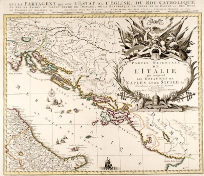
SANSON, NICOLAS: ISTRIA, DALMATIA AND THE REPUBLIC OF DUBROVNIK
The map depicts the entire Adriatic coast from Istria to Albania and hinterland all the way to the Sava River. All this area, except a very small part, is called Dalmatia. Relief is almost unrepresented, and river flows are displayed incorrectly (e.g. Kupa River). Map is obviously a part of a larger entity which is also seen by its name and which at the time of publishing became standard practice when geographic or political entities in the atlas already appeared on several sheets. Publishers Covens and Mortier succeeded Pierre Mortier in 1711 and published numerous atlases using maps by de L'Isle, Sanson and Jaillot. In this case, they attribute authorship to the most famous French cartographer Nicolas Sanson, who was not alive anymore (he died in 1667), in order to use his authority. The map is adorned with a large baroque cartouche, the size of which indicates the map is a part of a larger whole.

