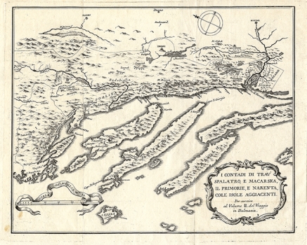
FORTIS, ALBERTO: TROGIR, SPLIT, MAKARSKA, NERETVA AND NEIGHBOURING ISLANDS
This map is from the 2nd book of the famous travelogue "Viaggio in Dalmazia", written by Alberto Fortis after several trips (in total duration of 10 months) in Dalmatia. On his journey in 1772, when he was already working on the book, he was followed by his friend Jack Harvey and the artist Angelo Donati. The final processing of the drawing, i.e. copper engraving, was probably entrusted to the famous copper engraver Giacomo Leonardi (Palmanova 1723 - Venice 1797), who made the other drawings in the travelogue. Although relatively small, the map shows the area from Trogir to the Neretva River and part of Pelješac with the islands of Šolta, Brač, Hvar, Vis and Korčula. The map is very legible. The shapes of islands, their relationships and their position in relation to the mainland are faithfully depicted, but like Fortis's map of Cres, the relief is deficient, so for example, Mosor is almost imperceptible. There are plenty of toponyms of small settlements and bays along the coastline.

