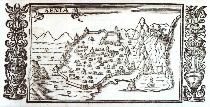
À VAREA, LASOR: VIEW OF THE TOWN OF SENJ
This view of Senj was in its entirety copied from one view by Vincenzo Maria Coronelli, published in his famous work “Citta, fortezze ed altri…” of 1688. Varea published this view in 1713 in his work “Universus Terrarum Orbis” on page 497. The map is primarily focused on the representation of the town’s fortification system. The “civilian” part of the town is illustrated only schematically. At the initial part of the west walls stood the tower Turina. From there the ramparts continued up to the tower of Ambroz and Pope’s tower and then to the towers Tribenac and Salapanok. The bastion Gulden constituted the extreme northern portion of the wall. The walls then run southwards up to the Kaštel that comprises two angular semi-integrated towers and one round tower called Philip’s tower. From the Philip’s tower the ramparts continued up to the towers Naša and Šabac that protected the church of St. Mary. The southern walls facing the sea and Sea gates were guarded by the port bastion (Pastein). The author repeated the erroneously marked setting of St. Mary’s church that was situated really next to the tower Šabac, here represented far more east outside the town. Above the town the fort of Nehaj can be seen, built in 1558 by captain Ivan Lenković of Senj.

