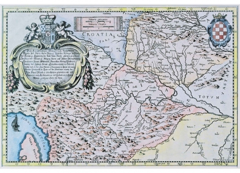
VALVASOR, JOHANN WEIKHARD: MAP OF CROATIA
This map of Croatia was published in the noted Valvasor's work "Die Ehre des Herzogthums Crain", most precisely in its fourth volume. The map shows the Kingdom of Croatia as it was during the war against the Turks when the entire Slavonia, Lika and Krbava were under Turkish occupation. The boundary with the Turkish Empire, as well as with Carniola is marked with a dotted line. The map was produced just one year before the massive military engagements in which most of these parts of the Croatian territory were re-taken and reunited with Croatia and Slavonia (the war ended in 1699), so that Valvasor's interest in showing the Croatian lands which at the time were one of the most dangerous battlefields in Europe is quite understandable. Valvasor who appears to have copied from the map of Croatia by Stjepana Glavač of 1673 also taking over distance measure units from it. Namely, it is for the scales given in the Croatian miles (Milliaria Croatica) that this map, as well as that of Glavač, is best known. The exact length of the Croatian mile has not been established until this very day (only its approximate value). The title of the maps is enclosed in a baroque cartouche placed in the upper left corner of the map. In the upper right corner of the map the coat of arms of the Kingdom of Croatia is engraved.

