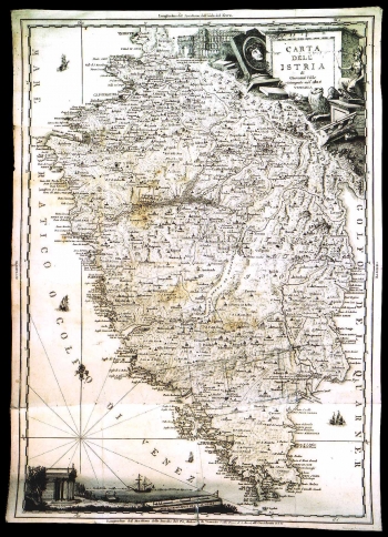
VALLE, GIOVANNI: MAP OF ISTRIA
This map of Istria is one of the later re-prints of Valle's map of Istria of 1792. This example was published by Giuseppe Gnesda in Venice in 1805. This very detailed map features the network of settlements and administrative-territorial units of Istria. The county of Pazin that in the times of the Republic of Venice was under Hapsburg rule is clearly outlined by a thick broken line. This map is historically very interesting as it was created at the time that followed immediately after the French took possession of Istria. Namely, after the fall of the Republic of Venice, in 1797, the whole Istria was put under Hapsburg rule. Shortly afterwards, in 1805, after the Peace Treaty of Požun was signed, Austria was forced to renounce parts of Istria formerly owned bay the Venice in favour of France, which for the county of Pazin resulted in being surrounded by the territories under French rule. The status that lasted until 1809, when the county of Pazin was included to form part of the Illyrian Provinces of the Napoleonic Empire. The title of the map is in its upper right corner contained in a monument shaped drawing. The illustration surrounding the title clearly reflects its neoclassical inspiration - monuments dating back to Antiquity are dominant - Roman amphitheatre in Pula, some other Roman stone monuments and the Temple of August are featured in the lower left corner of the map. A mileage scale is expressed in geographical miles.

