Hrvatski Deutsch English
Home Maps Authors p-t RIEDEL Carte de la Servien, de la Bosnie
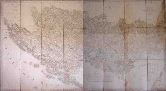
RIEDEL, ADRIAN FRANZ XAVER FLORIAN VON: MAP OF SERBIA, BOSNIA AND MUCH OF ILLYRICUM

RIEDEL, ADRIAN FRANZ XAVER FLORIAN VON: MAP OF SERBIA, BOSNIA AND MUCH OF ILLYRICUM

Inventory number 231
Original title: Carte de la Servien, de la Bosnie et d' une grande partie de Illyrie en 4 feuilles par Riedel
Publishing year: 1810
Place of publishing and publisher: Vienne
Format: ?
Technique: Copper engraving


This map of Bosnia, Serbia and parts of the Illyrian lands was based on rough drafts of the Hapsburg military topographers. Riedl’s map of Bosnia and Serbia is one of the rare maps based on information from military sources intended for the public use. For the aforesaid raison this is one of the most accurate civilian maps of Bosnia and Serbia of the time. While making his map Riedel used information gathered by the famous cartographer Johannes Lipszky von Szedliczne. Topographical features are presented with shaded relief. Riedel placed his greatest attention to the representation of the settlements and roads. The number of place names is exceptionally copious, so that Riedl’s map shows many small settlements till then not identified on any pre-existing map. However, Riedl's had not an equally complete knowledge of all of the regions covered, so, the representation of Herzegovina is set apart for its lesser quality obviously due to the fact that the information Riedl had  on this region was much less copious compared to that he had on other parts of Bosnia and Serbia.
RIEDL, ADRIAN FRANZ XAVER FLORIAN VON
RIEDL, ADRIAN FRANZ XAVER FLORIAN VON (1746-1809), a topographer and cartographer from Munich. His most significant works are Stromatlas von Baiern, created between 1806 and 1808, Reise Atlas von Bajern oder Geographisch-geometrische Darstellung aller bajrischen Haupt- und Landstrassen mit den daranliegenden Ortschaften und Gegenden: nebst Kurzen Beschreibungen alles dessen, was auf und an einer jeden der gezeichneten Strassen für den Reisenden merkwürdig seyn kann, published in five volumes (1796–1805), Moldau from 1811 and Servien und Bosnien, which was published as a map consisting of four sheets in 1810, and then republished in 1812. His father, CASTULUS RIEDL (1701-1783), from Freising, was a cartographer and mathematician in the Court Exchequer. He lived in Munich.
Print Friendly and PDF
Top