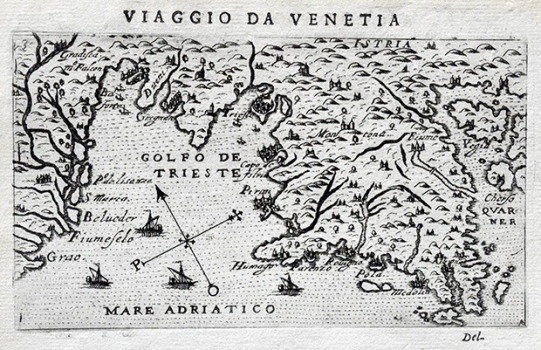
ROSACCIO, GIUSEPPE: MAP OF ISTRIA
This map of Istria comes form the first edition of Rosaccio’s travel-record work «Viaggio da Venetia a Constantinopoli per Mare, e per Terra, & insieme quello di Terra Santa» of 1598. The work went through at least two another editions - 1604 and 1606. This map of Istria by Rosaccio was based on an earlier map of Istria published in 1525 by the Istrian cartographer Petar Kopić (Pietro Coppo). The map shows Istria drawn on a very small scale identifying only a few major coastal towns – Trst, Kopar, Piran, Umag, Poreč, Pula, Medulin, Labin and Rijeka. The town of Motovun is the only that is identified in the interior of Istria. Along the right hand margin of the map parts of the islands of Krk and Cres can be seen. The relief is represented schematically as shaded molehills.

