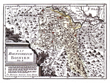
REILLY, FRANZ JOHANN JOSEPH VON: MAP OF THE KINGDOM OF BOSNIA
The map shows Bosnia within its medieval borders before Turkish invasion. By a dotted line indication is made of the borders established after the Treaty of Požarevac of 1718 according to which the border between Bosnia and the Ottoman Empire was shifted south of Sava. Next to the name of Banja Luka, key fortress in the system of defense of Bosnia, is stated the year 1737, recording the attempt to liberate the town made by the Austrian forces, under leadership of Hildburghausen, that failed. The western part of Bosnia is denoted as Turkish Croatia, the same as the other parts of Bosnia, at that time still under Turkish control. Below the map's margin, in the lower left corner the engraver left his signature: "I Albrecht SC." The title of the map is inscribed in stone monument in the lower left corner of the map. A mileage scale is in Italian, Turkish and German miles. Below the mileage scale there is a note stating that in Bosnia there isn't postal service organized. This map was published in Reilly's atlas "Schauplatz der Welt Atlas" (1789-1791).

