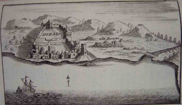
REUSCH, ERHARD: VIEW OF THE TOWNS AND FORTRESSES OF VENETIAN DALMATIA
These views of the towns and fortresses of Venetian Dalmatia are included in the work of Reusch Erhard «Alter und neuen Staat des Königreichs Dalmatien» published in Nürnberg kod njemaačkog izdavača Johanna Kaspara Monatha in 1718.In his work Reichard included the views of a number of the Croatian towns and fortresess, on the coast : Rijeka (S. Veith am Pflavm oder Fiume), island Rab (Insul Arbe), island Pag (In. Pago), town of Osor on the island of Cres (Osera), Senj (Zeng), Knin (Chnin), Vrana (Urania), Karin (Carin), Nadin (Nadin), Drniš (Dernis), Zemunik (Zemonico), Zadar (Zara), Šibenik and the surrounding countryside (Sebenico), Skradin and lake of Prokljansko jezero (Scardona, Lago di Prochlian), Trogir (Citta di Trau), Klis (Clissa), Split (Spalatro), island Hvar (Liesina Ins.), Makarska (Macarsca), island Korčula (Curzola), Sinj (Sing), Zadvarje and its surroundings (die Landschaft Duare), Opuzen (Opus) and Dubrovnik (Ragusa). The work comprises also the view of border-land fortress of Otočac (Ottozitz) which at the time of creation of this map formed part of the Military borderland, or more precisely of the Generalate of Karlovac. South of Dubrovnik then belonging to the province of Venetian Dalmatia, the following views are featured: the Golf of Cattaro, Risan (Risano), Herceg-Novi (Castelnuovo) and Budva (Budova) in the territory of present-day Montenegro and views of Drač (Durazo), Ulcinj (Dulzigno) and Skadar (Scutari) the then towns within the province of Venetian Dalmatia and today in Albania. All the named views are copied from the original contained in the work of the Venetian cartographer Vincenzo Maria Coronelli “Isolario dell Atlante Veneto” and the work of the Slovenian polyhistor Janez Vajkard Valvasor «Die Erde des Hertzoghums Crain» (To the glory of the Duchy of Carniola).

