SCHLIEBEN, WILHELM ERNST AUGUST VON: ZADAR REGION
Inventory number 372
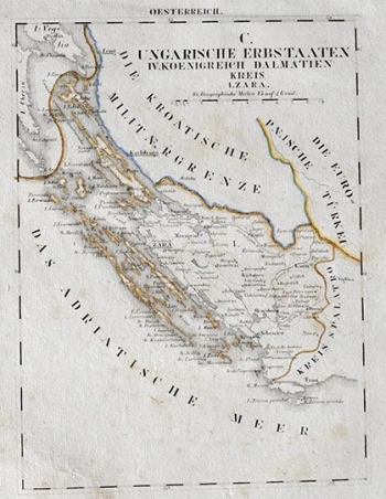
Original title: C. Ungarische Erbstaaten. IV Koenigreich Dalmatien Kreis 1. Zara
Publishing year: 1825
Place of publishing and publisher: Leipzig
Format: 26 x 19 cm
Technique: Litograph
A detailed map of the area of Zadar from Senj to Rogoznica was published in the large two-volume "Atlas von Europa, nebst den Kolonien, fur Geschaftmanner, Zeitungsleser ...", intended for "business people and newspaper readers". Probably because of its purpose, it does not deal with relief, but contains many toponyms and carefully drawn boundaries of the Croatian Military Border and the Ottoman Empire.
SCHLIEBEN, WILHELM ERNST AUGUST VON
SCHLIEBEN, WILHELM ERNST AUGUST VON (1781-1839), a cartographer from Dresden, who worked as a chief district land surveyor in Leipzig. He was the first Director of the Statistical Association of Saxony, and made his career as a military officer and professor of military science. He carried out land surveys in Thüringen and collected data of the Kingdom of Saxony for statistical purposes. He published works in the field of land surveying, war history, mathematics and geography. As far as Croatian cartography is concerned, his most significant works were published in the Atlas von Europa from1829 and the Mittheilungen des statistischen Vereins für das Königreich Sachsen, which was published from 1831 to 1839.

