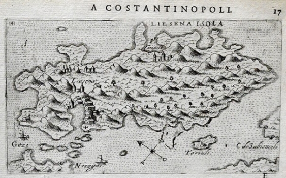
ROSACCIO, GIUSEPPE: VIEW OF HVAR
This view of the island of Hvar appeared in the first edition of Rosaccio’s travel-record book «Viaggio da Venetia a Constantinopoli per Mare, e per Terra, & insieme quello di Terra Santa» dated 1598 shows the island as seen from the open sea, i.e. from the southern side. The author placed his greatest attention to the representation of the town of Hvar, important Venetian military port. The port of Hvar is largely oversized to accentuate its importance. In the waterfront Paklinski otoci are shown, in the east the island of Šćedro and the promontory of Lovišće belonging to the peninsula of Pelješac are featured, as well as the northwest extremity of the island of Korčula. In the northern part of the island Starigrad and its bay are identified and highlighted with palace symbol. The topography of the island of Hvar is shown arbitrarily by roughly drawn shaded molehills. Rosaccio modeled his view upon an identical view of the island of Hvar published in Camoccio’s isloario in 1571.

