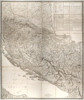
PAGANI, DOMENICO: MAP OF THE ILLYRIAN PROVINCES
This map of Illyrian provinces was published somewhere in Italy in 1813. It was made at a scale of 1:500 000 and comprises four sheets and it is graced with richly adorned margin. It shows the Illyrian provinces as established by the French at the time when they were abolished. In fact, by the Treaty of Schönbrunn signed in 1809, under the terms of which Dalmatia, all territories lying south of the river Sava, the Austrian part of Istria, Trst, Gorica, Carniola and western Carinthia were ceded to France. Napoleon unified all those territories in one administrative unit named the Illyrian Provinces the capital of which was established in Ljubljana. The French administration lasted until 1813. The map is a compilation from Austrian and Italian military maps of the said area. The Italian engineer Domenico Pagani compiled the map from Austrian and Italian military maps of the said territories. The Italian engineer Domenico Pagani made the map and B. Bordiga drew the relief. A particular emphasis was placed on the landforms (relief), as well as on the network of streams and rivers as all that was important for the movements of the army. The scale of the map is expressed in metrical system and in Italian and French miles. The map’s title is placed in the upper right corner with statistical tables containing description on the side.

