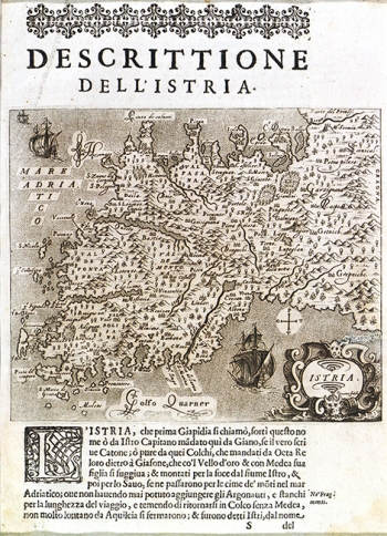
PORCACCHI DI CASTIGLIONE, TOMASO: MAP OF ISTRIA
The map was engraved on the cooper plate and printed by Girolamo Porro, engraver and publisher from Padua, active in Venice during the second half of the 16th century. Tomasao (Tomas) Porachi drew the map for his work “L ‘Isole del Mondo”, whose first edition appeared in Venice in 1572. This example comes from the second edition published in 1605 (its last edition was published in 1686). The map itself is based on Petar Kopić's map of Istria from 1540 published in the work “Del sito de Istria”. Considering its small dimensions, this map gives relatively large quantity of place names of the coastal and inland Istrain areas. Off the Istrian coast the Rovinj and Medulin islets are identified together with the surrounding rocks, as well as the Islands of Brijuni. The coastal line is featured with oversized contours of the channel of Lim and of the mouth of the river Mirna. The field Čepićko polje is presented as a marshy lake out of which the river Raša is streaming forth. The forested character of the inland and southern Istria is highlighted by symbols of tree. The topography shown with molehills is completely fictitious. Along the eastern bank of the river Raša the note is placed reading “fine d’ Italia”. The title of the map is contained in a late-Renaissance cartouche placed in the lower right corner reflecting the pronounced influence of Abraham Ortelius.

