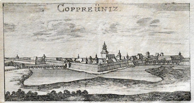
RIEGEL, CHRISTOPH: VIEW OF KOPRIVNICA
Inventory number 295
Author: RIEGEL, CHRISTOPH
Original title: Copreüniz
Publishing year: 1688
Place of publishing and publisher: Wien, Leipzig
Format: 5,8 x 11,4 cm
Technique: Wood-cut
This map view shows the fortress of Koprivnica as it was in the mid 17th century. It is based on one earlier view of Koprivnica issued in 1660 by Martin Stier. The map image shows Koprivnica from its North West side. In the foreground, earthen fortifications and the northern gates accessed through the bridge spanning the town’s moat are featured. The West town gates built in the 16th century can also be seen. The bell-tower of the Franciscan church dedicated to the Holy Virgin Mary, at the time of this map used as the parochial church of Koprivnica, is the only that stands out of the town’s contours. This town view comes form the work «Das Ehemals gedrückte von Turken» published in Frankfurt and Leipzig in 1688.
RIEGEL, CHRISTOPH
Christoph Riegel (?-1714) – a German map editor. He worked in the second half of the 17th century.

