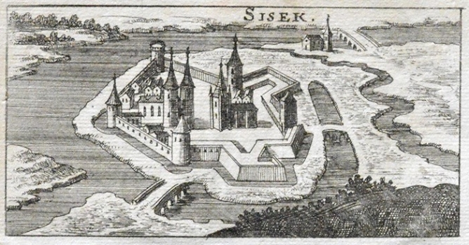
RIEGEL, CHRISTOPH: VIEW OF SISAK
This map image of Sisak comes form the work «Das Ehemals gedrückte von Turken» published in Frankfurt and Leipzig in 1688. It is based on a number of earlier town views issued on the occasion of the famous battle near Sisak fought in 1593. The picture of Sisak shown does not correspond to what the town looked like at the time of the map. The view shows a completely idealized image the purpose of which was to glorify the magnitude of the victory of the Christian army against the Turks. That is the reason why the image of Sisak on such views was not realistic, so, the fortress is often considerably enlarged, or shown as a monastery or as having a vast church within its ramparts. Such representation of Sisak is the result of the fact that its fortress was among the possessions of Zagreb Diocese, so in everybody’s minds was related to the church (in the reality the size of the fortress of Sisak was quite small and consisted of three towers connected with walls).

