PEETERS, JACQUES: VIEW OF KOSTAJNICA
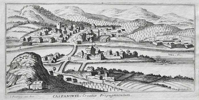
This view of Kostajnica is based on an identical Hoefnagel’s view published in 1617 in Braun-Hogenberg’s «Civitates Orbis Terrarum». The view shows Kostajnica, more precisely its Croatian part (present-day Hrvatska Kostajnica) and its Bosnian part (present-day Bosanska Kostajnica) as it was during the Turkish rule. Namely, at the time this view was made, Kostajnica was a key fortification, which guarded the entrance to the northwestern Bosnia. Due to its exceptional strategic importance, military topographers of the Habsburg armed forces made secretly the map of Kostajnica with its surroundings. The map shows the settlement of Kostajnica, which consisted of three distinct parts: the greater part of the settlement comprising a Turkish-style center (which is today Bosanska Kostajnica) situated on the right-side bank of the river Una. A wooden bridge provided a way across the river Una connecting the old town with the river islet and the fortress on it, as well as with the part of Kostajnica on the left riverbank (present-day Hrvatska Kostajnica). The title is across the lower margin edge.
PEETERS, JACQUES
