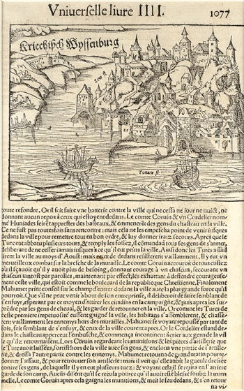
MÜNSTER, SEBASTIAN: VIEW OF BELGRADE
The view shows Belgrade viewed from the Danube (Tonaw fl.). Two boats on the river were drawn as decorations in the foreground. A fortress on the side of Sava (Saw fl.), a part of the Belgrade fortress and the area around it – Kalemegdan are also represented. Belgrade used to be an ancient Roman castrum and a medieval Byzantine fortification, and then a well-established capital of Serbian Despotate. As the 'key to Hungary' or 'the bastion of Christianity', the Ottomans conquered it in 1521, when the Lawgiver Suleiman proclaimed it the seat of the Smederevo Sanjak-bey and his base for further inflammation against Hungary and Austria. As a center of commerce and a Danube port during the 16th century, the city further orientalized, but this is not noticeable on this panoramic view. This map is a part of page 1077 of the book with the French text on the Conflict of the Ottomans and Christians. It was probably a part of Münster's Cosmographiae. Griechisch-Weißenburg was the usual medieval name of the capital of Serbia until the Ottoman expansion in the 16th century, when the Slavic name Beograd spread.

