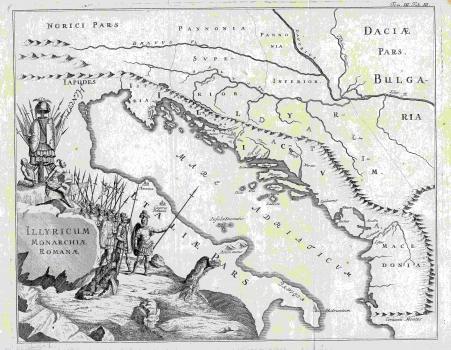
MONATH, PETER CONRAD: ILLYRICUM UNDER ROMAN ADMINISTRATION
Inventory number 428
Author: MONATH, PETER CONRAD
Original title: Illyricum Monarchiae Romanae
Publishing year: 1748
Place of publishing and publisher: Wien / Nürnberg
Format: 28 x 36,4 cm
Technique: Copper engraving
The third map, which has a title identical to the original, shows on the same geographical basis the administrative division of the country before the fall of the Western Roman Empire, according to the works of Roman historians. Monath is much more restrained in decoration of this map, because he needed room to show Pannonia and Dacia, so the gorgeous view is placed in the lower left corner of the map, on the territory of Italy, and shows the progress of the Roman army.
MONATH, PETER CONRAD
MONATH, PETER CONRAD (1682-1747), a polyhistorian, cartographer and publisher from Nuremberg, who later moved to Vienna. He specialized in the works of astronomy and mathematics. Together with Johann Gabriel Doppelmayr and Johann Georg Puschner, he also sold globes in the Vienna branch of his bookstore. His most well-known works are Grundriss Belgrad from 1717 and Dalmatien from 1718.

