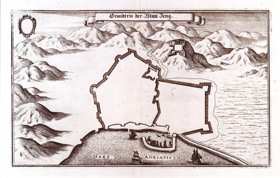
MERIAN, MATTHÄUS: VIEW OF SENJ
This map image of the town of Senj was published in Merian's "Theatri Europei Oder Historische Beschreibung aller Vornemdsten und denckwürdigsten Geschichten, so sich hin weider in Europa sonderlich im Reich Teucher Nation von Anno 1642 bis Anno 1647". Merian's map of Senj was based on a very similar map made in 1639, by Giovanni Pieroni, an Austrian military topographer tasked with the inspection of the Croatian Military-Confines fortifications. In the map is shown the town of Senj completely surrounded by walls in the form of an irregular pentagram with 11 semicircular, circular and square towers. The defense-walls reached as far as town port safeguarded by the fortress of Šabac. The fortress of Kaštel (Castello), dwelling-place of Senj's rectors and captains, situated in the vicinity of the Great Gates also named Land Gates, towers over the north eastern part of the walls. Above the town is shown the fortress of Nehaj built in 1558 by General Lenković. At that time the town had only three gates - Land Gates (Porta di terra), Sea Gates (Poerta di mare) e Small Gates adjacent to the fortress of Šabac (Porto). What makes different Merian's map from the map made by Pieroni is the representation of the eastern walls. Namely, the fortification system of Senj as presented on Merian's map consists of two systems of walls. The western walls really existed, while the eastern ones have never been built, although some propositions in this sense had been made.

