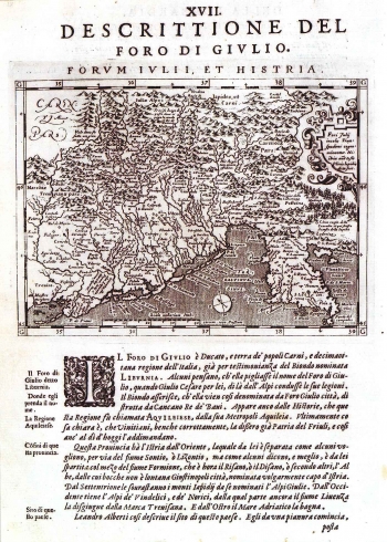
MAGINI, GIOVANNI ANTONIO: MAP OF FRIULI AND ISTRIA
Inventory number 57
Author: MAGINI, GIOVANNI ANTONIO
Original title: Descrittione del foro di Giulio. Forum Iuli et Histria
Publishing year: 1596
Place of publishing and publisher: Venezia
Format: 13,5 x 18 cm
Technique: Copper engraving
This map was issued in Magini's edition of Ptolemy's "Geographya" dating from 1596, entitled "Geographiae universae tum veteris tum novae absolutissimum opus duobus voluminibusdistictum". Girolamo Porro engraved copper plates for this issue. This map represents the last derivation of Ortelius' map "Fori Julii accurata descriptio" published in his atlas of 1570 and Bertelli's 1573 map having the same name. Even after its edition by Mangini, this map continued to reappear in many Dutch editions (ref. cat. numbers 81 and 66). Their content is practically the same. The title of the maps is above the upper margin edge.
MAGINI, GIOVANNI ANTONIO
GIOVANNI ANTONI MAGINI (1555-1617) - respected astronomer and mathematician. He issued one of Ptolemy's Geography editions whose issue in Magini's edition that included 37 new maps, was published in Venice in 1596. The other important Magini's work is the Atlas of Italy featuring all the Italian regions on as much as 61 cartographic map images.

