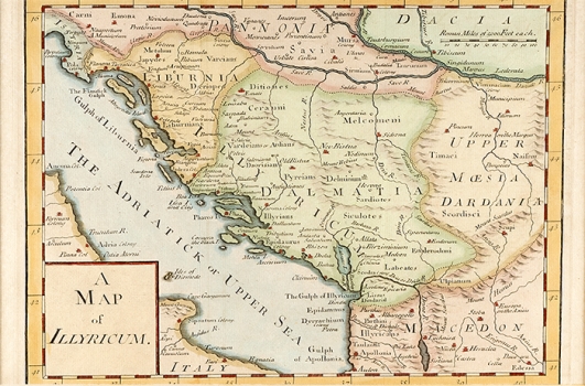
UNKNOWN: MAP OF ILLYRICUM
This map shows the Roman province of Illyricum with all territorial entities it comprised in Roman times along with adjoining provinces (Pannonia, Dacia, Moesia Superior and Macedonia). Besides province boundaries and major settlements, the names of the early groups of inhabitants of Illyricum and surrounding areas are given. The most part of the map area occupies the Roman province of Illyricum that was founded in the 1st century and consisted of two entities: Pannonia and Dalmatia. Liburnia whose main town was Zadar is also delineated due to the fact that that district had some individuality within Dalmatia. After the fall of the Roman Empire the name of Illyricum also disappeared to be revived and reintroduced in fashion by the editions of "Geographia" of Claudius Ptolemy, a Greek astronomer, mathematician and cartographer. The humanists of the Renaissance period introduced the custom to name lands and peoples by their classical names, so, at that period the name Illyricum reappeared on the maps. In the 1830s the name Illyrian and Illyric was related to the Croatian national revival movement. The title of the map is in the lower left corner contained in a plain box. A mileage scale is expressed in Roman Miles. The map is from one of the editions of historical map atlases that were issued in London at the end of the 18th century and the beginning of the 19th century.

