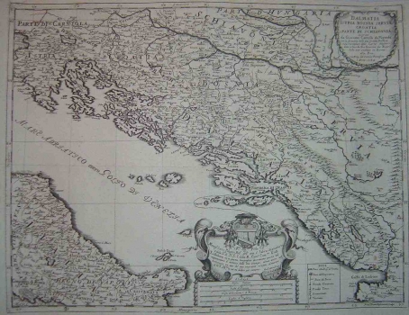
CANTELLI DA VIGNOLLA, GIACOMO: MAP OF DALMATIA, ISTRIA, BOSNIA, SERBIA AND CROATIA
This Cantelli’s map shows all of the today’s Croatian lands except for a part of the medieval Slavonia (the area around Zagreb in today’s Croatia). The author’s intention was to show Croatia within its medieval boundaries, but the result contains many inaccuracies. Dalmatia is identified within the boundaries of the ancient Roman province of Dalmatia. Zagreb is identified two times, as Agram and as Zagrabia. In the representation of the river system there are also quite inaccurate. The relief is shown with shaded molehills. The map was made after earlier originals, principally after those by Gerhard Mercator. However, Cantelli obviously disposed with some more up-to-date data which can be seen from his differentiating between the settlements under Christian rule and those ruled by Turks in Dalmatia and Herzegovina (see the map’s legend), which means that he was informed of the Turkish conquests achieved during the 16th and 17th centuries. The map’s title appears in the upper right within a floral cartouche. A mileage scale is expressed in Italian, Polish, German and Hungarian miles.

