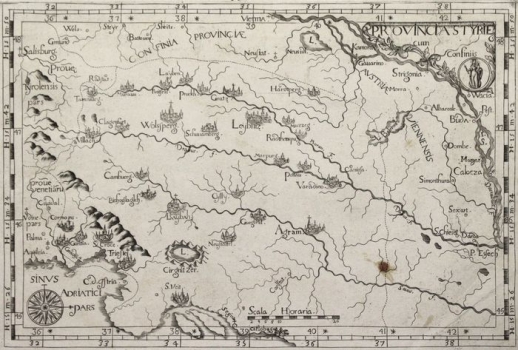
MAP OF THE CAPUCHIN PROVINCE OF STYRIA
The map shows the administrative division of the Capuchin parishes with the borders of the provinces from Tyrol in the north, Aquileia in the west to Pest and Osijek (P. Essech) in the east. It was published in the work “Chorographica descriptio provinciarum et conventuum FF. Min. S. Francisci Capucinorum ”, which was first published in Turin in 1643. The author was Giovanni da Moncalieri, General of the Capuchin Order. New maps like this were added to the atlas by Giovanni Battista da Cassino in 1712. The seats of the parishes, especially the cities of Wolfsberg (Wolssperg), Leibnitz (Leybniz), Ljubljana (Laybah) and Zagreb (Agram) are indicated by veduta representations. The 32-section compass rose is located in the lower left corner. The geographic grid is inscribed in the frame of the map, and the page number 62. is indicated above the upper edge. The simple title cartridge of Provincia Styriae is located in the upper corner next to the medallion of the patron saint of the church. The accompanying page of the atlas of the same issue numerically lists the contents of the Capuchin province of Styria, which consists of 5 bishops, with 99 priests, 103 clerics and 148 lay people. The document also records the neighboring provinces bordering Styria, which are faithfully marked by a dotted border line.

