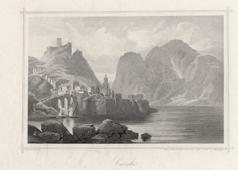
BIERMANN, F.: VIEW OF KORČULA
This view of the town of Korčula was made around 1875 by F. Biermann for his graphic map. The publisher of the map was Austrian Lloyd Trieste. The map image offers the view on the town of Korčula form the angle of the promontory of Pelješac, i.e. from the North. At first site it is already obvious that this is not a realistic view of that town, but a map image based on impression left with the author from some descriptive or narrative source on the town of Korčula. The configuration of the land on which the town is located, on the map is shown as markedly abrupt and rocky which does not correspond to the reality. In the town’s urban structure medieval forts and cathedral church can be recognized, but also illustrated with many inaccuracies. The arched bridge and the fortress above the town are also the fruit of the author’s imagination.

