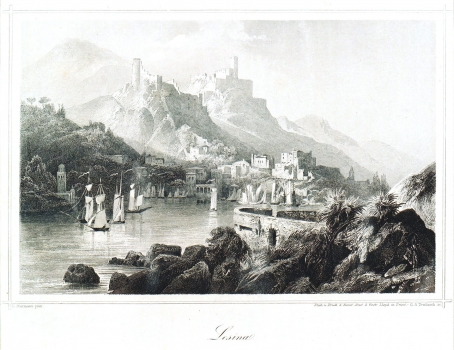
BIERMANN, F.: VIEW OF THE TOWN OF HVAR
This unusual view of the town of Hvar was made F. Biermann around 1875. It was published in Trieste in edition of the Austrian insurance company Lloyd. This town view apparently formed part of the graphical map of F. Biermanna, as it suggests its similarity with Bierman's earlier views of some other Dalmatian towns edited by the Austrian Lloyd. This map image offers the view of the town of Hvar as seen from the islet of Gališnik, which guards the entrance to the port of Hvar. However, the town is not represented realistically, but according to the painter's impression apparently left captivated by the fortifications above the town. The configuration of the land where the town itself is located is shown on the map as markedly steep and mountainous. The urban structure of the town of Hvar is hardly recognizable. Amongst the structures included can be identified with the certainty only the town lounge and the clock tower whose representation dominates the central part of the port. The main features of the map are the fortifications: the fort Španjol and the forts on the hill Nad Dolcem built, during the French rule in Dalmatia, in 1806. The land configuration on which the forts are located is also quite fictitious. Taking into consideration numerous disproportions shown it appears obvious that this view was based on descriptive or narrative sources and that in all probability F. Biermann personally never saw the town of Hvar.

