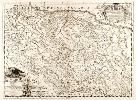
CANTELLI DA VIGNOLLA, GIACOMO: MAP OF SERBIA
This Cantelli's map was published in the atlas “Mercurio Geografico” printed in Rome in 1692 by Giacomo Rossi. It was based on the data gathered in the roman archives, and on the accounts of merchants and priests who returned to Rome from their travels bringing new information on the countries making part of the Ottoman Empire. This excellent cartographer and geographer mainly worked for the Papal state and was also the official cartographer of the duke of Modena. The map was produced some time during the Austro-Turkish wars within in the Serbian territory while under Turkish occupation. The map shows the division of Serbia into church administrative units (episkcopates) labeled as episcopate of: Beograd, Smsmederevo, Niš and Skopje. In the upper right corner is an elaborate baroque cartouche which contains a dedication to the cardinal Alfonso Litti: “ Alla Ill(ustrissi)mo, e Rev(endissi)mo Sig (nore) P(ad)ron(e) Col(londissi)mo Mons(ignore) Alfonso Litta Chierico della Rev(endissima) Cam(er)a Ap(osto)lica…”. The title of the map is in a baroque cartouche adorned with symbols reminiscent of warfare and victory: eagle, helmet and war flags. A mileage scale is expressed in Italian, French and German miles.

