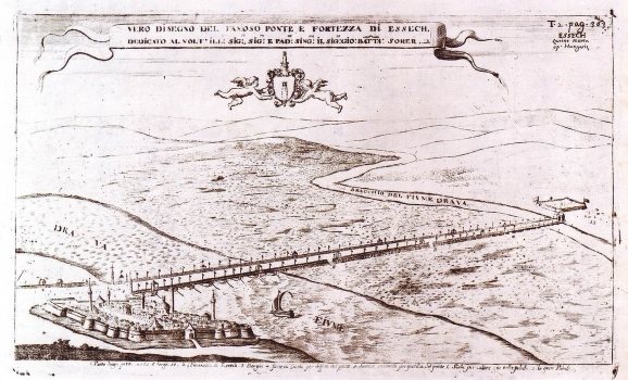
À VAREA, LASOR: VIEW OF OSIJEK
This view of Osijek was based on Cantelli's view he made in 1684. The Italian cartographer Raffaelo Savanarola, active in the 18th century, and best known under his fictitious name Lasor À Varea made this version. This map image was published in his work "Universus Terrarum Orbis" 1713. It represents the town of Osijek fortified as it was while under Turkish rule with impressive Sulejman's bridge across the river Drava. The emphasis is put on defense-walls and on the bridge dominating this map view. Within the town 5 minarets are to be seen. The title is shown in a simple banner cartouche in the upper part of the map. The map legend is below the lower margin edge with explanation regarding objects marked with numbers: 1. Ponte lungo passi 8 565 e'largo 17 2. Fortezza d Essech 3. Borghi 4. Forte di Tarda per diffesa del Ponte 5. diverse sentinelle per guardia del' passo 6. scale per calare nella palude 7. la gran Palude

