Articles per page:
View:
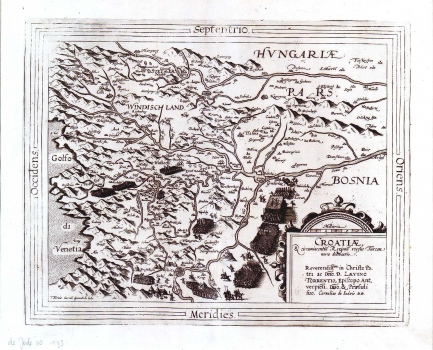
DE JODE, GERARD: MAP OF CROATIA
Inventory number: 61
Author: DE JODE, GERARD
Original title: Croatiae et circumiacentium Regionum versus Turciam nova delineatio. Reverendissimo in Christo parti as Domino Laevino Torrentio, Episcopo Antverpiensi. Domino et Praesuli suo
Publishing year: 1593
Place of publishing and publisher: Antwerpen
Format: 34 x 41 cm
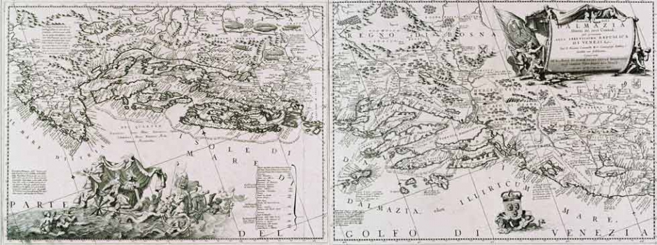
CORONELLI, VINCENZO MARIA: ADMINISTRATIVE MAP OF DALMATIA
Inventory number: 65
Author: CORONELLI, VINCENZO MARIA
Original title: Ristretto della Dalmazia divissa né suoi Contadi già presentata alla Serenissima Republica di Venezia
Publishing year: 1690
Place of publishing and publisher: Venezia
Format: 2 x: 46 x 60 cm
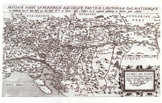
DE JODE, GERARD: MAP OF ILLYRICUM AND SLAVONIA
Inventory number: 90
Author: DE JODE, GERARD
Original title: Illyrici seu Sclavoniae, contentis Croatiam, Carniam, Istriam, Bosniam, eisquae conterminas provincias, recens emendatus typus / auctore Augustin Hirschvogel
Publishing year: 1593
Place of publishing and publisher: Antwerpen
Format: 30 x 51 cm
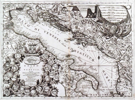
CORONELLI, VINCENZO MARIA: MAP OF THE ADRIATIC SEA
Inventory number: 95
Author: CORONELLI, VINCENZO MARIA
Original title: Golfo di Venezia, descritto Dal Padre Minorita Coronelli Cosmografo della Serenissima Republica, ad uso dell’ Accademia Cosmografica degli Argonauti. Dedicato All’ Eccellenza del Signor Giulio Giustinian, Procuratore di San Marco, etc. in Venezia Con privilegio dell’ Eccellentissimo Senato
Publishing year: 1688
Place of publishing and publisher: Venezia
Format: 45 x 60,5 cm

WALDSEEMÜLLER, MARTIN: THE 5TH MAP OF EUROPE
Inventory number: 105
Author: WALDSEEMÜLLER, MARTIN
Original title: Tabula V Europae
Publishing year: 1535
Place of publishing and publisher: Lyon
Format: 30 x 46 cm
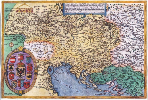
DE JODE, GERARD: MAP OF THE DANUBE BASIN
Inventory number: 107
Author: DE JODE, GERARD
Original title: Fluvii Danubis Tractus / Cristian Sgrooten
Publishing year: 1593
Place of publishing and publisher: Antwerpen
Format: 33,5 x 49,5 cm
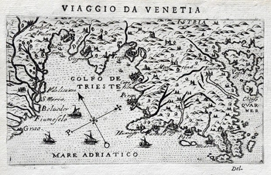
ROSACCIO, GIUSEPPE: MAP OF ISTRIA
Inventory number: 240
Author: ROSACCIO, GIUSEPPE
Original title: Istria
Publishing year: 1598
Place of publishing and publisher: Venezia
Format: 10 x 17,5 cm
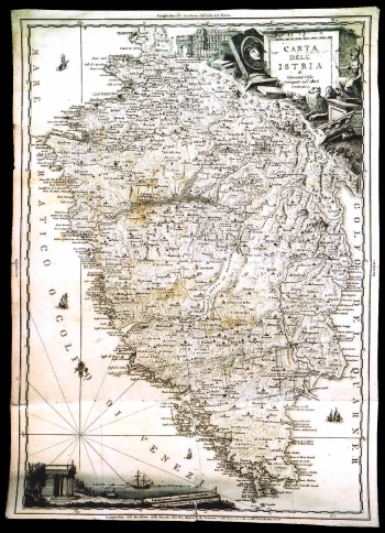
VALLE, GIOVANNI: MAP OF ISTRIA
Inventory number: 175
Author: VALLE, GIOVANNI
Original title: Carta dell’ Istria di Giovanni Valle: ristampata del 1805
Publishing year: 1805
Place of publishing and publisher: Venezia
Format: 64 x 45,5 cm
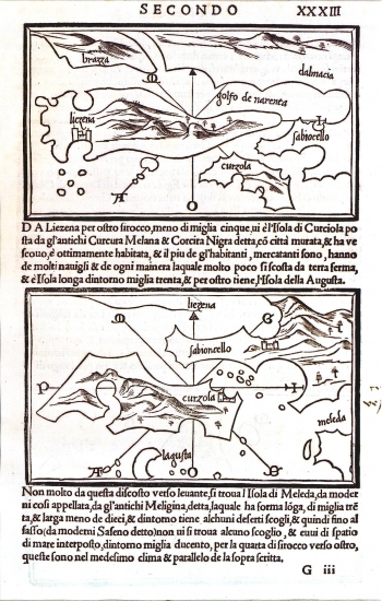
BORDONE, BENEDETTO: CHART OF HVAR, KORČULA, BRAČ, LASTOVO AND PELJEŠAC
Inventory number: 49
Author: BORDONE, BENEDETTO
Original title: Brazza, Lieczena, Curzola/ Benedetto Bordone Curzola, Lagustra, Sabioncello/ Benedetto Bordone
Publishing year: 1532
Place of publishing and publisher: Venezia
Format: 8,5x14,5 cm
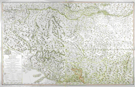
SCHIMEK (SCHIMECK), MAXIMILIAN: MAP OF BOSNIA AND THE SURROUNDING COUNTRIES
Inventory number: 213
Author: SCHIMEK, MAXIMILIAN
Original title: Das Koenigreich Bosnien und die Herzegovina (Rama) samt den angtenzenden Provinzen von Croatien, Sclavonien, Temesvar, Servie, Albanien, Ragusa, und dem venetianischen Dalmatien
Publishing year: 1788
Place of publishing and publisher: Wien
Format: 56 x 67 cm
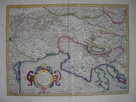
MERCATOR (KREMER), GERHARD: MAP OF FRIULI, KARST, CARNIOLA, ISTRIA AND SLOVENIAN MARK
Inventory number: 214
Author: MERCATOR (KREMER), GERHARD
Original title: Forum Julium, Karstia, Carniola, Histria et Windorum Marchia
Publishing year: 1595
Place of publishing and publisher: Duisburg
Format: 35 x 47 cm
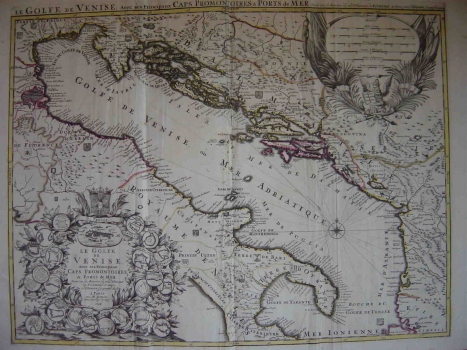
SANSON, NICOLAS: MAP OF THE ADRIATIC SEA
Inventory number: 215
Author: SANSON, NICOLAS
Original title: Le Golfe de Venise avec ses Principaux Caps, Promontories et Ports de Mer. Dressé sur les Memories les plus Nouveaux du Pére Coronelli, et autres; Par le Seigneur Sanson, Geographe du Roy
Publishing year: 1696
Place of publishing and publisher: Paris
Format: 55,5 x 74 cm
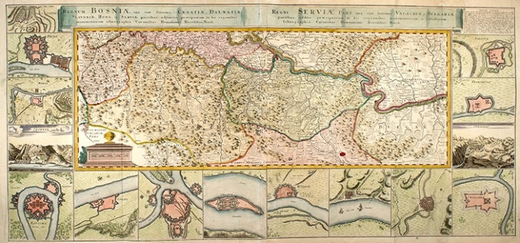
ÖTTINGER, JOHANNES: MAP OF THE KINGDOM OF BOSNIA, SERBIA AND NEIGHBOURING COUNTRIES
Inventory number: 233
Author: ÖTTINGER, J. F.
Original title: Regnum Bosniae, una cum finitimis Croatiae, Dalmatiae, Slavoniae, Hungariae et Serviae partibus, adjuncta praecipuorum in his regionibus munimentorum ichonographia. Regni Servia pars, una cum finitimis Valachiae, Bulgariae partibus, addita praecipuorum in his regionibus munimentorum et castellorum ichonographia.
Publishing year: 1738
Place of publishing and publisher: Nürnberg: Homannianis Heredibus
Format: 29 x 80 cm
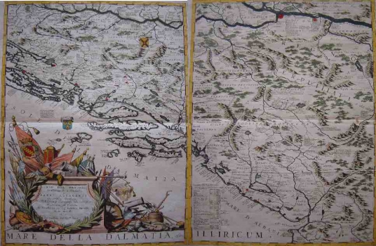
CORONELLI, VINCENZO MARIA: MAP OF DANUBE BASIN
Inventory number: 235
Author: CORONELLI, VINCENZO MARIA
Original title: Corso del Danubio da Vienna sin' à Nicopoli e paesi adiacenti Descritti, e Dedicati Dal Padre Maestro Coronelli Cosmografo della Serenissima Republica di Venetia
Publishing year: 1695
Place of publishing and publisher: Venezia
Format: 2 x 60 x 45 cm
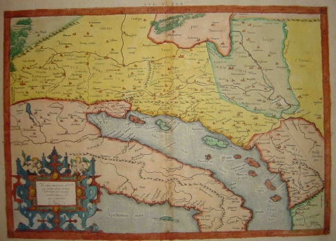
MERCATOR (KREMER), GERHARD: THE FIFTH MAP OF EUROPE
Inventory number: 268
Author: MERCATOR (KREMER), GERHARD
Original title: Europa V Tabula
Publishing year: 1584
Place of publishing and publisher: Köln
Format: 32,2 x 45,8 cm
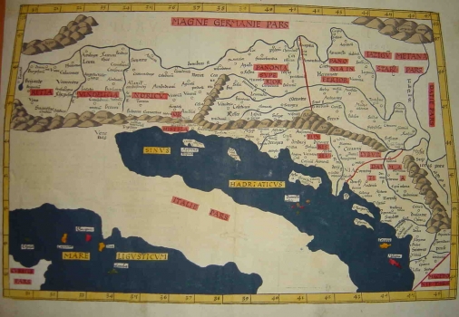
WALDSEEMÜLLER, MARTIN: THE FIFTH MAP OF EUROPE
Inventory number: 269
Author: WALDSEEMÜLLER, MARTIN
Original title: Europa V Tabula
Publishing year: 1541
Place of publishing and publisher: Vienne
Format: Europa V Tabula
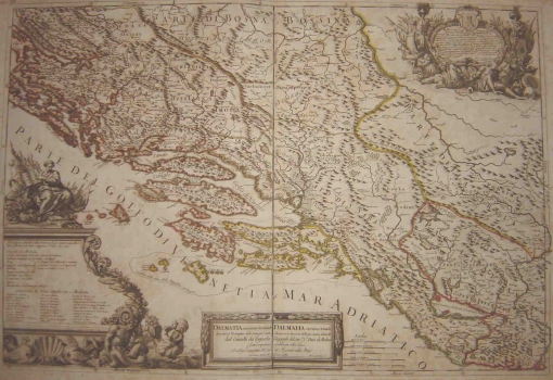
CANTELLI DA VIGNOLLA, GIACOMO: MAP OF DALMATIA
Inventory number: 314
Author: CANTELLI, DA VIGNOLA GIACOMO
Original title: Dalmatia maritima Occidentale e Dalmatia maritima Orientale
Publishing year: 1689
Place of publishing and publisher: Roma, Giacomo Rossi
Format: 56,5 x 82,8 cm
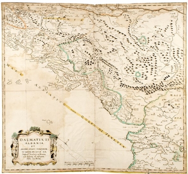
SCOLARI, STEFANO: MAP OF DALMATIA AND ALBANIA
Inventory number: 453
Author: SCOLARI, STEFANO
Original title: Dalmatia et Albania et altri stati confinanti
Publishing year: 1640
Place of publishing and publisher: Venezia
Format: 51 x 55 cm
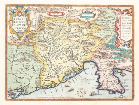
ORTELIUS, ABRAHAM: MAP OF FRIULI, VENETIA AND ISTRIA
Inventory number: 494
Author: ORTELIUS, ABRAHAM
Original title: Fori Iulii accurata descriptio
Publishing year: 1598
Place of publishing and publisher: Antwerpen
Format: 35,5 x 48 cm
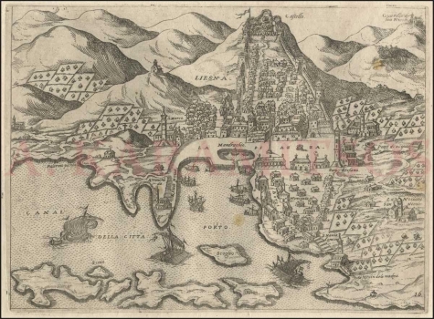
CAMOCIO, GIOVANNI FRANCESCO: TOWN OF HVAR
Inventory number: 506
Author: CAMOCIO, GIOVANNI FRANCESCO
Original title: Liesna
Publishing year: 1571
Place of publishing and publisher: Venezia
Format: 17 x 23,2 cm

SZEMAN, JOSEPH: VIEW OF ZAGREB
Inventory number: 489
Author: SZEMAN, JOSEPH (JOSEPHUM, JOSIP)
Original title: Prospectus L. R. Civitatis Zagrabiensis ad meridiem
Publishing year: 1822
Place of publishing and publisher: Wien
Format: 45 x 63 cm
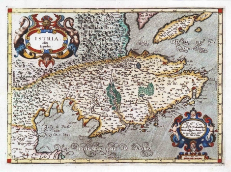
MAGINI, GIOVANNI ANTONIO: MAP OF ISTRIA
Inventory number: 115
Author: MAGINI, GIOVANNI ANTONIO
Original title: Istria olim Japidia
Publishing year: 1620
Place of publishing and publisher: Bologna
Format: 34 x 46,5 cm
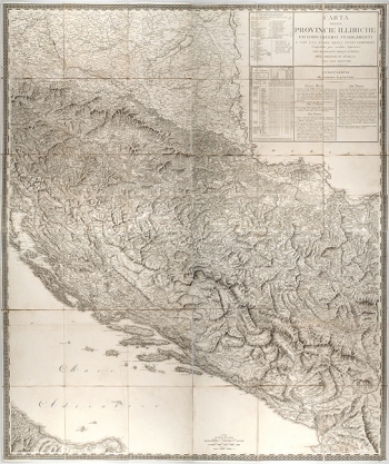
PAGANI, DOMENICO: MAP OF THE ILLYRIAN PROVINCES
Inventory number: 356
Author: PAGANI, DOMENICO
Original title: Carta delle Provincie Illiriche co`loro diversi stabilimenti e con una parte degli stati limitrofi. Compilata per ordine Superiore nel deposito della guerra del Regno d’ Italia nell’ anno MDCCCXIII
Publishing year: 1813
Place of publishing and publisher: ?
Format: 4 x 65 x 54 cm
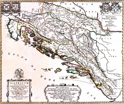
LUČIĆ, IVAN (IOANNES LUCIO): MAP OF ILLYRICUM
Inventory number: 164
Author: LUČIĆ, IVAN
Original title: Illiricum Hodiernum, Quod Scriptores communiter Slcavoniam, Itali Schiavoniam nuncupare solent, in Dalmatiam, Croatiam, Bosniam et Sclavoniam distingitur…
Publishing year: 1730
Place of publishing and publisher: Amsterdam: Jean Covens, Cornelis Mortier
Format: 43,5 x 52,5 cm
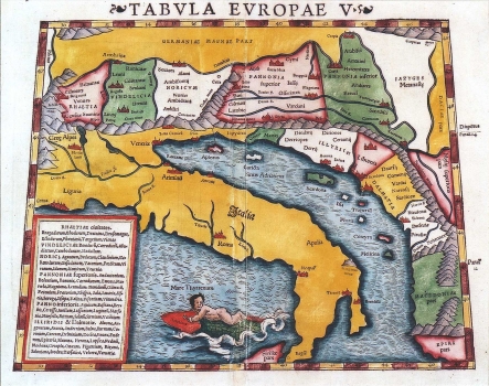
MÜNSTER, SEBASTIAN: THE 5TH MAP OF EUROPE
Inventory number: 120
Author: MÜNSTER, SEBASTIAN
Original title: Tabula Europae V
Publishing year: 1551
Place of publishing and publisher: Basel
Format: 27 x 34 cm
Total : shown 25
- 1