VAN DER BRUGGEN, JOHANN: KINGDOM OF CROATIA
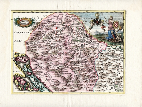
The map of Croatia is like the map of Slavonia without a year and a signature, but identical to a map printed in Vienna in 1737. According to the map of Slavonia, Croatia is located to the south of the Sava River, so that Zagreb is not shown, extending eastwards to the Vrbas and Pliva River, and to the south to the Adriatic Sea, from Bakar to the south of the island of Pag, which disagrees with van den Bruggen’s map of Dalmatia. The mountains are marked very arbitrarily, e.g. Velebit is not particularly prominent. The map's geographical shortage compensates a decorative view in which two cherubs hold a two-edged eagle, and beside them stands a proud girl with a bruised chest, a sabre in one hand, and a shield with a Croatian coat of arms whose division resembles the chessboard in the other, who treads with her leg a woman-witch with a torch that probably symbolizes the Ottoman danger.
VAN DER BRUGGEN, JOHANN
