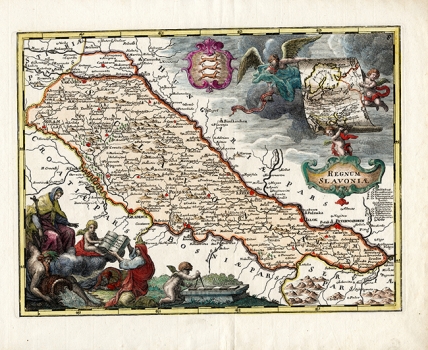
VAN DER BRUGGEN, JOHANN: KINGDOM OF SLAVONIA
Inventory number 382
Author: VAN DER BRUGGEN, JOHANN
Original title: Regnum Slavoniae
Publishing year: 1740
Place of publishing and publisher: Augsburg
Format: 24,5 x 32,5 cm
Technique: Coloured copper engraving
The author of the map is undisputedly van der Bruggen, because the map is identical to his signed map published in Vienna in 1737. The map depicts Slavonia, which covers the entire area between Sava, Drava and Danube, so it includes Varaždin and Zagreb in the west, extending to Belgrade to the east. Three cherubs hold a large map of Central and Northern Europe above the cartouche, as if they want to confirm the affiliation of Slavonia to Europe, and next to them there is a Slavonian coat of arms with three weasels. In the lower left corner, Virgin Mary blesses a book in which Srijem and Baranja are inscribed, and close to this, the mythological god of water is feeding one of the rivers that surround Slavonia.
VAN DER BRUGGEN, JOHANN
VAN DER BRUGGEN, JOHANN (1695-1740), an engraver in Prague and Vienna, who in 1737 published maps of Austria in 11 sheets. For Croatian cartography, the following sheets are of significance: Regnum Croatiae, Regnum Slavoniae, Regnum Dalmatiae, Regnum Bosniae.
