REILLY, FRANZ JOHANN JOSEPH VON: MAP OF SOUTHERN ISTRIA
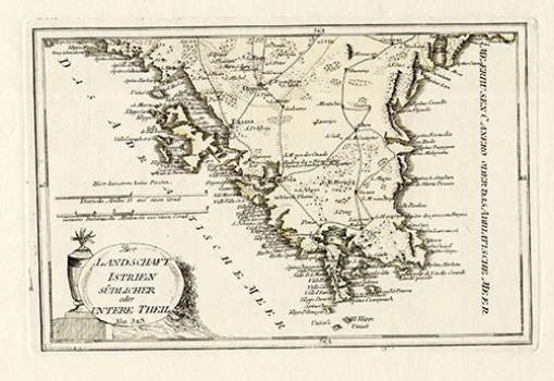
This Reilly’s map made part of his three-section map of Istria that featuring the southern part of the Istrian peninsula stretching from Krnice (Carnizza d’ Arsa) and St. Vitale (San Vitale) on the north to the caps of Premantura on the south. The map shows major settlements of southern Istria and the roads connecting them. Many fewer place names are indicated in the inland area of Istria compared to those labelled in its coastal area. Special attention is placed in the annotation of coastal place names and numerous Istrian bays. The map’s title appears at lower left contained in an oval stone-shaped cartouche. A mileage scale is in both German and Italian miles. This map was published in Reilly’s atlas entitled “Schauplatz der Welt Atlas” issued between 1789 and 1791.
REILLY, FRANZ JOHANN JOSEPH VON
