FIFTH MAP OF EUROPE
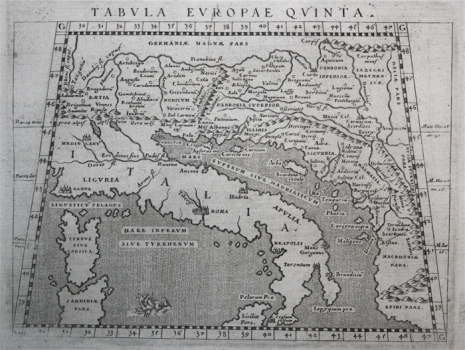
This map is noticeably similar to Rosaccio-Magini's version of the Fifth Map of Europe from the Felbar Collection (inv. no. 569), although the latter is older, larger and coloured. This map also represents a part of very late adaptations of the classic Ptolemy’s plates depicting Roman provinces from Germania in the north to Italia in the south, with more toponyms and the orographic and hydrographic content inscribed for the eastern Adriatic mainland. Croatian lands include provinces from Noricum in the west to Liburnia and Dalmacia in the southeast and Pannonia Superior in the north. The numerical values of the geographical coordinates are inscribed on the map, as a trace of Ptolemy's contribution to the history of cartography. Apart from its similarity to Rosaccio's work, Ruscelli's influence on all Italian users and adapters of Ptolemy's Geography was visible until the late 17th century. Comparison with other maps from the Felbar Collection (Ruscelli's map inv. no. 70, Münster's – no. 120, Stirk's – no. 33, and Waldseemüller's maps inv. nos. 97, 105 and 269) show modifications of the same template over time.
MAGINI, GIOVANNI ANTONIO
