KINDERMANN, JOSEPH KARL: MAP OF CARINTHIA AND KRAIN
Inventory number 480
Author: KINDERMANN, JOSEPH KARL
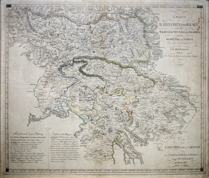
Original title: Charte von Kaernthen und Krain nebst den graftschaften Gorz und Gradiska und dem Gebiethe von Triest
Publishing year: 1809
Place of publishing and publisher: Kunst und Industrie Comptoir, Wien
Format: 46,5 x 57,5 cm
Technique: Litograph
The map was most likely published in the „Atlas des Oestreichischen Kaiserthums“, which appeared in several editions between 1797 and 1805, i.e. after the fall of the Venetian Republic and before the creation of the Illyrian Provinces. It shows Carniola and Carinthia, part of Istria and the area of Trieste. Great attention is paid to the relief and the road network, but the map is not legible.
KINDERMANN, JOSEPH KARL
KINDERMANN, JOSEPH KARL (1744-1801) a Hungarian historian, geographer and cartographer from Buda-Kescy. His most notable works are Klagenfurter Kreiss from 1790, Inner-Oesterreich in 11 sheets from 1790-1800, Boehmen from 1803, and Atlas Oesterreich Kaiserthums in 40 sheets from 1805.
