MAGINI, GIOVANNI ANTONIO: NINETH MAP OF EUROPE
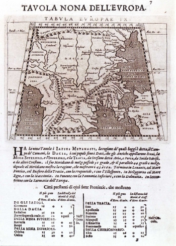
As the previous one, this map was also published in Magini's 1596 issue of Ptolemy's "Geography". But, these were not new maps (Tabula nova) but re-prints of "The 9th map of Europe" by Ptolemiy featuring the southern part of the region of Dalmatia (Albania) ant the Roman provinces of Makedonia and Dacia. The descritption of these and the index of settlements with respective coordinates (geographical longitude and latitude) are shown below the map image. In fact, Ptolemy employed geometric coordinate system to determinate geographical position of the settlements presented on its maps. In this, his measurement of latitude was exceptionally precise, while the longitude calculations compared to the values actual today show considerable discrepancies. The measurement of longitude is based on a prime meridian through so called Happy Islands, i.e. now days Canaries (about 16° of the western geographical longitude through Greenwich). The introduction of geometric co-ordinate network, is the most important Ptolemy's contribution to the development of the Cartography.
MAGINI, GIOVANNI ANTONIO
