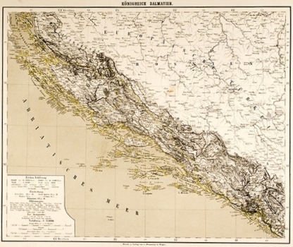
FLEMMING, CARL: MAP OF DALMATIA
This large overview map shows Dalmatia within the framework of a separate Austrian crown land, or as part of the Habsburg Monarchy. As Bosnia is part of the Ottoman Empire on the map, it is a territorial representation of the division of territory before 1878. An explanation of the territorial division is also found in the title cartouche in the lower left corner, together with the map key and the numerical and graphical scale. In the north, Dalmatia borders the Military Frontier (Militair Grenze). The term Europäische Türkei is recorded in the Ottoman territory in Bosnia. The contours of the coastal and insular lines of Dalmatia are very detailed, and the relief is emphasized in detail by hatching, though somewhat generalized. As was the case with the Flemming map of Dalmatia and Montenegro from the Felbar Collection (no. 312, no. 346) and with an almost completely identical map of different dimensions, in this case the cartographic and geographical precision was based on topographic data of the detailed topographic survey of Dalmatia in the first half of the 19th century. The title is written above the top edge. The map was published in Hand-Atlas über alle Teile der Erde, in collaboration with Heinrich Berghaus and Karl Sohr.
FLEMMING, CARL
