GOERÖG (GORÖG), DEMETER: THE DISTRICT OF SYRMIA
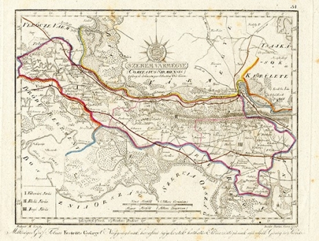
This map is one of the earliest drawings, although it was printed only in 1811. It can be seen in the lower right corner that the map was engraved as early as 1798. This testifies how long Gorod was preparing for printing the first atlas of Hungarian and Croatian counties. The area of Srijem County is divided into three districts, of which only the first (Vukovar) and a smaller part of the other (Ilok), are now a part of the Republic of Croatia. The main settlements, Vukovar and Ilok, were marked, as well as relief and wetland areas along the Danube River to some extent. There are two major roads. One goes along the Danube, from Vukovar to Ilok and further to Novi Sad in Vojvodina. The second one goes from Vinkovci via Šid to Srijemska Mitrovica and probably further to Belgrade. Considering the early creation date, the map resembles copper engraving much more than some later maps from the same atlas. Like most Slavonian counties' maps, this one is also dedicated to Count Đuro Feštetić.
GOERÖG (GORÖG), DEMETER
