FORMALEONI, VINCENZO ANTONIO: THE ISLAND OF KVARNER BAY
Inventory number 408
Author: FORMALEONI, VINCENZO
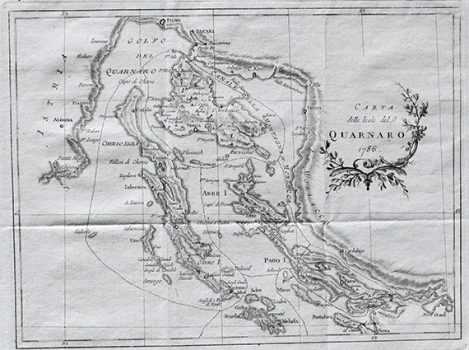
Original title: Carta delle Isole del Quarnaro (sic)
Publishing year: 1787
Place of publishing and publisher: Venezia
Format: 23,7 x 31,1 cm
Technique: Copper engraving
The map is most likely from a respected book 'Topografia veneta o descrizione dello stato veneto, dietro le migliori notizie e decrizione delle provincie particolari... '. On the trail of Fortis's travels, it describes in detail Kvarner and Zadar in Part 1, and the area of Dalmatia to Kotor in Part 2 and Part 3. It is considered one of the best topographic representations of the Croatian coast. The map shows the coast from Rijeka to Obrovac and the islands of Krk, Cres, Lošinj, Rab, Pag, etc. and indicates mountains and other elevations with skillful shading. The island of Rab is somewhat moved to the north, and this also happens somewhat in Pag and particularly in Molat.
FORMALEONI, VINCENZO
