FRANCO, GIACOMO: ISLAND OF HVAR
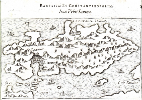
This map comes in all probability from one of the editions of Rosacco's isolaro “Viaggio da Venetia a Costantinopoli” or from some of its later re-works. It was modelled upon Bordone's isolario-style representation of island of Hvar of 1532. In this representation of the island Camocio’s attention was mostly placed on the town of Hvar, an important Venetian military port of that time. Above the town, whose urban structure is hardly recognizable, a fortress is shown. The bay of Hvar has oversized contours in proportion to its importance. In the foreground, can be seen the islands of Pakelni otoci, to the east are the island of Šćedro and the promontory Lovišće jutting into the sea out of the peninsula of Pelješac, as well as the northwest part of the island of Korčula. In the northern part of the island of Hvar Starigrad highlighted with palace symbol and the bay of Starigrad are shown. The topography of the island of Hvar is quite fictitious illustrated with roughly drawn and shaded molehills.
FRANCO, GIACOMO
