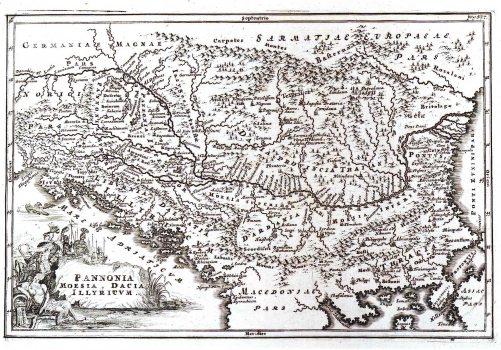
CELLARIUS (KELLER), CHRISTOPHORUS: MAP OF PANNONIA, MOESIA, DACIA AND ILLYRICUM
This map of Pannonia, Moesia, Dacia and Illyricum was drawn by Celalrius (Keller) Christophorus, a Dutch cartographer, (1638-1707). It was first published in his work "Notitia Orbis Antique". This historical map represents the Roman provinces with their respective delimitation as established by the emperor Diocletian while reorganizing the Empire in 297 BC. In the lower left corner is a very decorative cartouche with drawing of the Roman troops while crossing the Danube as symbol of the expansion of the Roman Empire to the north of the Danube in times of Marcus Aurelius during the second half of the 2nd century. Cellarius' maps was based on the map "Pannonia et Illyrici veteris Tabula", copper engraving by Abraham Ortelius issued in 1590 in his famous atlas "Theatrum Orbis Terrarum".
CELLARIUS (KELLER), CHRISTOPHORUS
