À VAREA, LASOR: VIEW OF THE TOWN OF BUDVA
Inventory number 152
Author: A VAREA, LASOR
Original title: Budova
Publishing year: 1713
Place of publishing and publisher: Padova
Format: 8,5 x 13 cm
Technique: Copper engraving
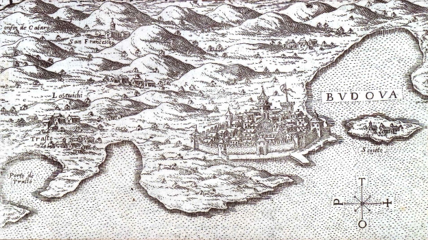
This map image appeared in Varea's work “Universus Terrarum Orbis” of 1713, on page 208. It shows the fortified town of Budva with its ramparts and bastions inside which lay the inner city. In front of Budva the island of St. Nicolas in the Golf of Budva is featured. The map image reaches as far west as the golf of Traste and the homonymous port. At the time of creation of this map the whole represented area formed part of Venetian Dalmatia.
A VAREA, LASOR
LASOR À VAREA - a fictitious name of Raffael Savanarola, that was an Italian cartographer from the 18th-century. His most famous work is "Universus Terrarum Orbis" dating from 1713.
