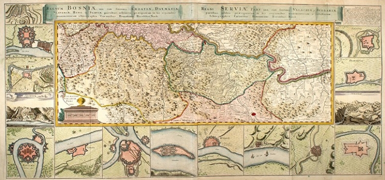
ÖTTINGER, JOHANNES: MAP OF THE KINGDOM OF BOSNIA, SERBIA AND NEIGHBOURING COUNTRIES
Oettinger’s map of Bosnia, Serbia and the neighbouring countries was made after the Peace Treaty of Požarevac of 1718 that concluded one of many wars fought between the Austrians and the Turks. This map shows a new position of the border established by the said Treaty. By the new demarcation the Austrian –Turkish border was shifted 6-10 kilometres further south from the river Sava integrating the Bosnian Posavina into Slavonia, i.e., into the Hapsburg Monarchy. The new Austro-Turkish border in Serbia is now placed to the south of the river Morava. The war atmosphere is reflected by the plans of military fortresses shown along the map’s margin edge: Vidin, Nikopolje, Niš, Čačak, Sarajevo, Kragujevac, Valjevo, Užice, Brod, Bihać, Zvornik, Rača, Šabac, Beograd and Oršava.
ÖTTINGER, J. F.
